
Yellowstone National Park

Cave Falls Video 1 ~ Yellowstone National Park
Cave Falls Video 2 ~ Yellowstone National Park

Cave Falls Video 3 ~ Yellowstone National Park
Cave Falls Video 4 ~ Yellowstone National Park


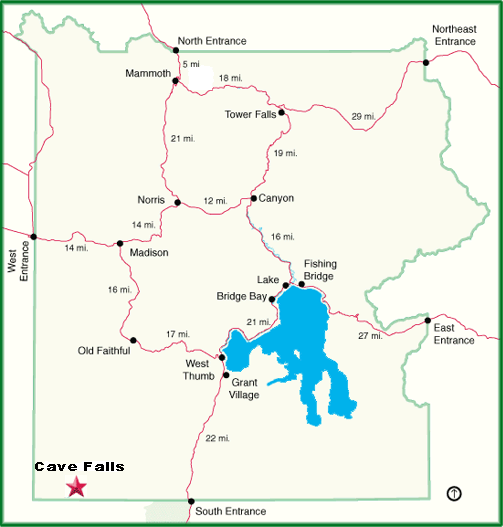
From Highway 20 at Ashton, Idaho, access the Mesa Falls Scenic Byway (Idaho State Road 47). Follow Idaho State Road 47 for about six miles to the Yellowstone National Park / Cave Falls sign. Take a right onto this road and continue to the picnic areas. These picnic area are about 26 miles from Ashton, Idaho, 11 of which are on a good gravel road. This expansive waterfall of the Falls River in the southwest corner of the park is only 20 feet high, but its spectacularity rests in the fact that, at 250 feet wide, it is probably the park's widest waterfall. Its immediate upper step is about 3 feet high and a lower step about a 100 yards downstream is around 5 feet high. Explorer W. C. Gregg and topographer C. H. Birdseye named the fall in 1920 - 1921 for the existance of a 50 by 50 foot cave just below the falls on the river's north bank. Gregg wrote: "The cave is one of those extravagant gifts of the Creator, thrown in on top of more than we could ask for." Please note that the "Cave" on the north end of the falls collasped a number of years ago and no longer exists. |
| Cave Falls Information | |
|---|---|
| Location | 44° 08' 37.62" N / 110° 59' 49.97" W |
| Elevation | 6232 feet / 1,900 meters |
| Fall Type | Two-tiered Plunge |
| Height | 20 feet / 6.1 meters |
| Stream | Falls River |
| Access | Approximately 26 miles northeast of Ashton, ID on Cave Falls Road |
| The above information is from the book "Yellowstone Waterfalls and their Discovery" by Paul Rubinstein, Lee H. Whittlesey, and Mike Stevens. |
 |
 |

Wildlive Videos
Yellowstone Wildlife Videos
Geysers and Thermals
Yellowstone Geysers and Thermal Videos
| Yellowstone Geyser and Thermal Videos | |
|---|---|
| Beehive Geyser Eruption | Old Faithful with Bison |
| Beehive Geyser Eruption Two | Pocket Basin |
| Fan and Mortar | Roaring Mountain |
| Grand Geyser | Rocket and Grotto |
| Old Faithful One | West Thumb |
Waterfalls
Yellowstone Waterfall Videos
| Yellowstone Waterfall Videos | ||
|---|---|---|
| Cave Falls | Mesa Falls | Undine Falls |
| Gibbon Falls | Rustic Falls | Upper Falls |
| Lower Falls | Tower Fall | Wraith Falls |


| Yellowstone National Park WebCams | |||
|---|---|---|---|
| Old Faithful Live | All Old Faithful | Old Faithful Static | Old Faithful VC |
| North Entrance | Mt Washburn | Mammoth | YVO WebCam |
| Entrance Cities and Gateway Towns | |||
|---|---|---|---|
| Gardiner, Montana | Silver Gate, Montana | West Yellowstone, Montana | Cooke City, Montana |
| Livingston, Montana | Cody, Wyoming | Jackson Hole, Wyoming | Yellowstone National Park |

| Links | |
|---|---|
| The Great Outdoors Net | Great Outdoor Recreational Places |
| Gardiner, Montana | West Yellowstone, Montana |
 |  |